


In a state known for its microclimates, Washington State University’s AgWeatherNet has been providing localized weather information to growers for more than 40 years.
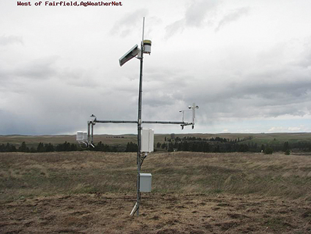
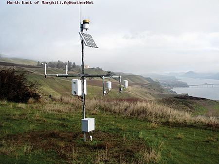
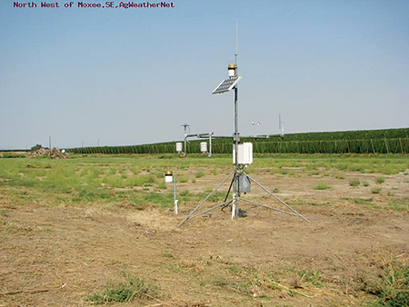
According to Lav Khot, director of AgWeatherNet, the system dates back to the 1980s when rudimentary weather stations were deployed, mainly in central Washington, to help tree fruit and grape growers predict extreme weather events, such as a frost, that could damage crops. Since the 80s, the system has grown substantially, expanding into western Washington and the dryland regions of Eastern Washington. In 2008, there were 139 stations. Today, the network has 228 open field weather stations, and it is one of the largest automated agricultural weather networks in the country. Stations report raw data, such as air and soil temperature, relative humidity, rainfall, wind speed and direction, soil moisture, and solar radiation, every 5 to 15 minutes. That data is checked for quality before being posted to AgWeatherNet’s website, weather.wsu.edu, which is updated every 15 minutes.
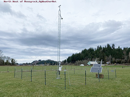
Keeping up with technology can be difficult, and weather data collection is no exception. AgWeatherNet has begun modernizing its equipment and has installed 57 33-foot towers to map mesoscale weather within a 25-mile radius. Using funding from the Washington State Department of Agriculture, AgWeatherNet is installing an additional 35 towers. Khot hopes to eventually have one in every county. The system has also expanded its data collection.
“We have added air quality sensors that quantify particulate matter and wildfire smoke-related hazardous volatiles as this has become an issue to stakeholders,” he said. “And importantly, we have now temperature coming from 30 feet, also wind at 33 feet. That helps us to get better temperature inversion mapping.”
In addition to its own stations, AgWeatherNet also collects data from 140 grower-owned private stations and networks. Growers can install their own hardware at a site of their choosing and send in data. AgWeatherNet uses the same quality control protocols on the private network that it does on their own network. AgWeatherNet sends alerts to growers if there’s an issue with the quality of the data, such as a misreporting temperature probe or a clogged rain gauge. The private network offers AgWeatherNet decision support that is tied to the grower’s preferred private weather station. These stations also improve spatial coverage of AgWeatherNet in the Pacific Northwest.
“We do our best to be in each county, but we are resource constrained, and in those scenarios where we cannot put our station in at a given site or anywhere that a grower wants, then they can add their station to supplement what we have as our network in that county or in that region,” Khot explained.
Khot said over the years, the information that farmers need from AgWeatherNet has stayed pretty consistent. Fruit growers want to know about extreme temperature events for heat or frost, growing degree days and the phenological models, and pest management scenarios. Dryland wheat growers want to know what the soil moisture is, and how much rain accumulated in a region. What has changed is data delivery, especially around extreme weather events.
“The National Weather Service does the forecasting of the region, and growers can look at that, but Washington has these rolling hills and all these microclimates that differ from what is forecasted by the National Weather Service,” he explained. “Growers rely a lot more on either their measurements or the nearest station. We have responded to that need by doing a 10-day, station-specific weather forecast.”
Stakeholders have also been asking for more decision support tools. AgWeatherNet now includes tools such as a cold hardiness model that gives tree fruit and grape growers information on how varieties might tolerate low temperatures. Another tool, the cattle comfort index, gives cattle growers high temperature alerts so they can adjust the animals’ diets as necessary. And wheat growers can now use the aforementioned inversion data to help schedule chemical applications.
“We now have real time inversions mapped on each tower station, and we also do the forecast of the inversion for the next three days,” Khot said. “Ideally, what you get to do is choose a station near you, and it will tell you what the best time windows to spray are.”
The team at AgWeatherNet is also working on a way for growers to use a custom group of sensors to monitor a specific area using a private sensing network. For example, a tree fruit farmer who just wants to monitor temperature, humidity, or soil moisture on a 10-acre block can now add those networks within AgWeatherNet. These networks have been rolled out for a few farmers in central Washington who are using them for frost mitigation.
To take full advantage of AgWeatherNet’s data and tools, growers will need to create a sign-in. By having users sign into the website, the team can track which stations are being used, which helps them plan preventative maintenance. It also stops private companies from poaching AgWeatherNet’s data. Without a sign-in, visitors to the website can see the station map and get basic weather facts from specific stations. There’s also a 10-day weather forecast.
“AgWeatherNet is one of the best resources growers have, and everything is free,” Khot said. “We try our best to deliver good quality data and decision support. A lot of growers don’t know about us.”